Geothermal Resource Data, Tools, and Maps
Explore geothermal resource data via our online geospatial tools and downloadable U.S. maps and data sets.
Geospatial Data Tools
Geothermal Prospector
An NREL-hosted interactive mapping application that merges a variety of geothermal
datasets from numerous government and university sources.
Geothermal Data Repository
A U.S. Department of Energy-hosted directory of geothermal data submitted by researchers.
Renewable Energy Atlas
View and explore renewable energy resource data.
Tribal Energy Atlas
Explore techno-economic renewable energy potential on tribal lands.
Renewable Energy Data Explorer
NREL's REDE applications featuring geothermal datasets that are available for the
following countries:
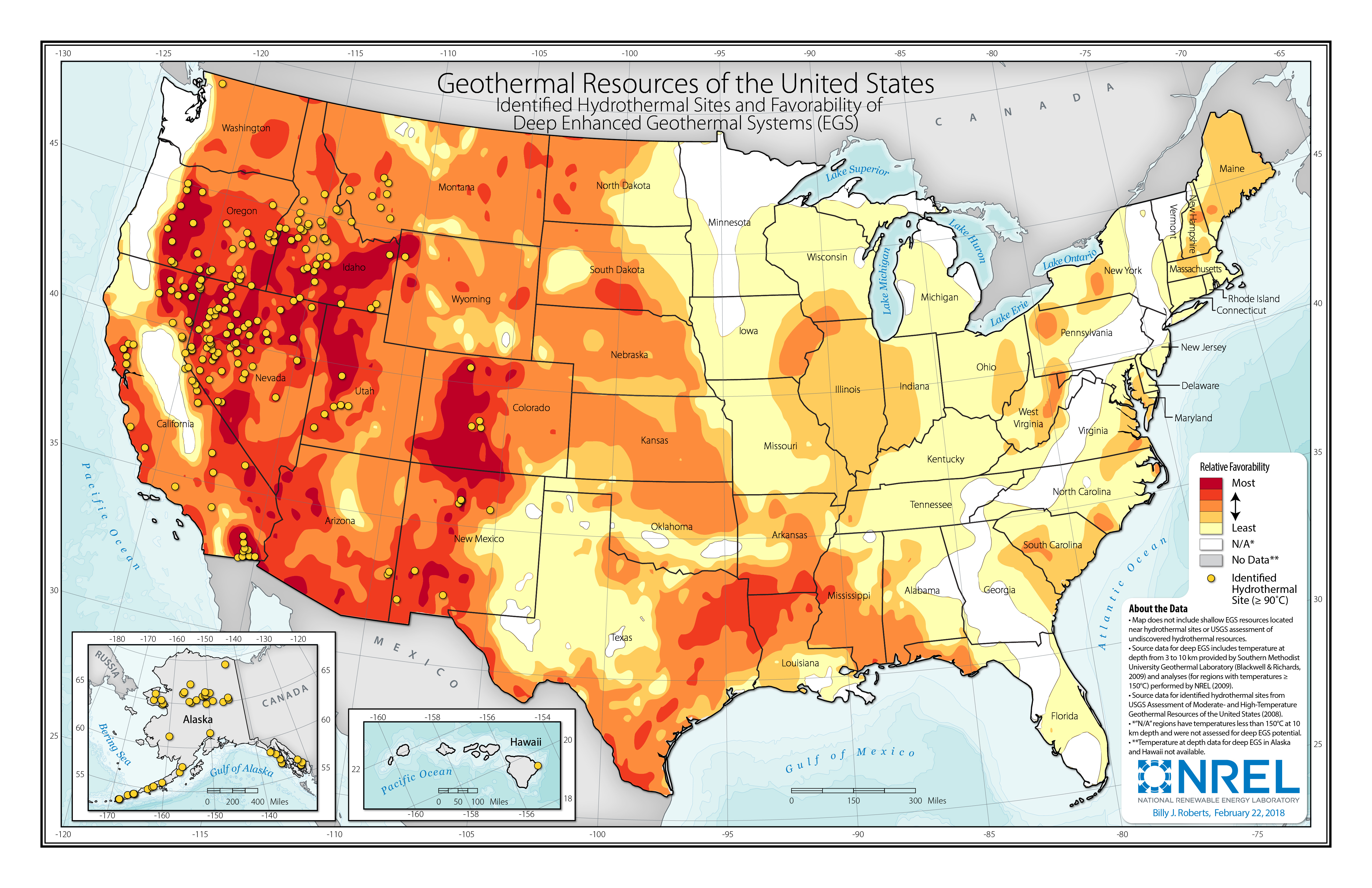
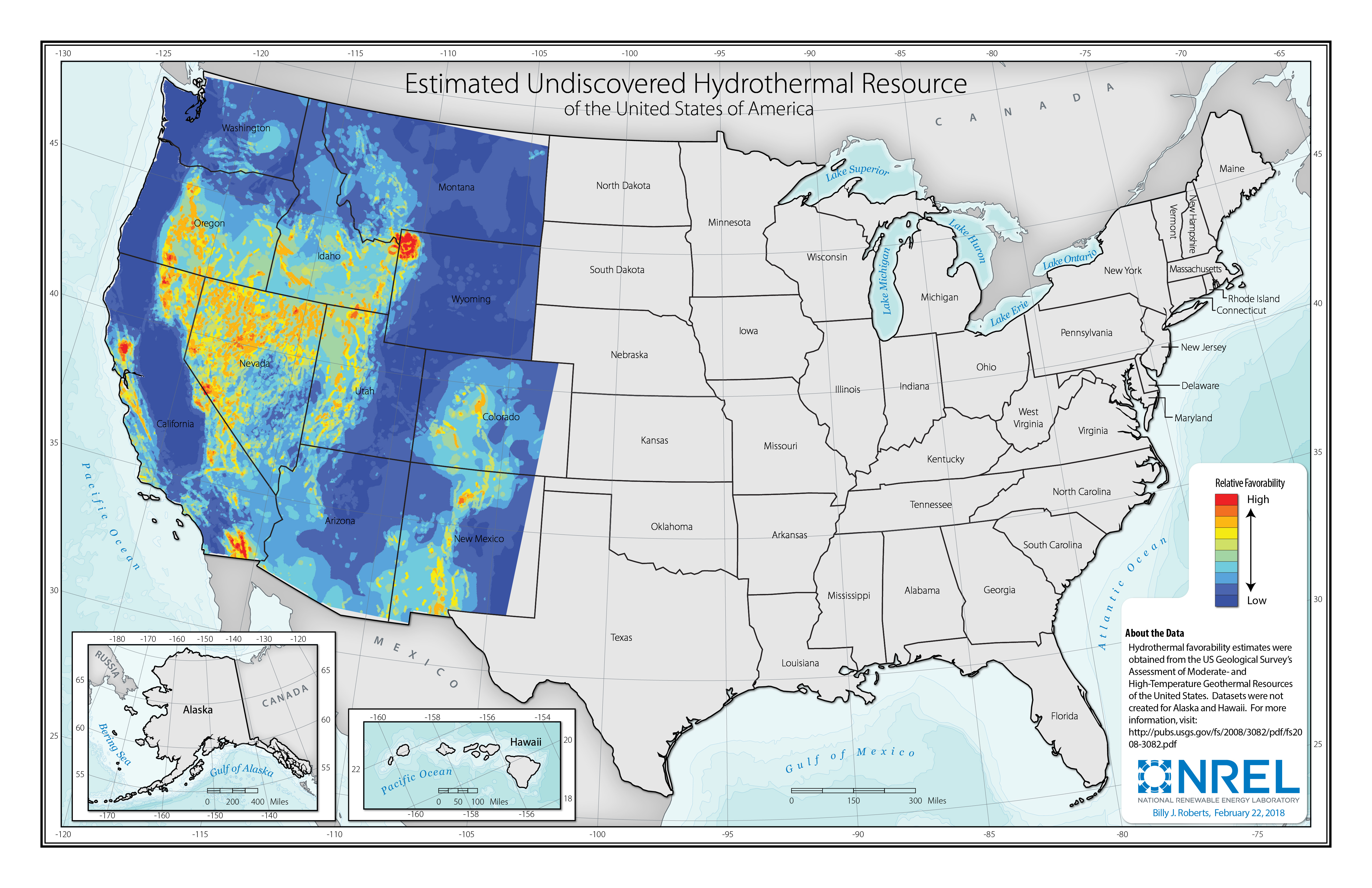
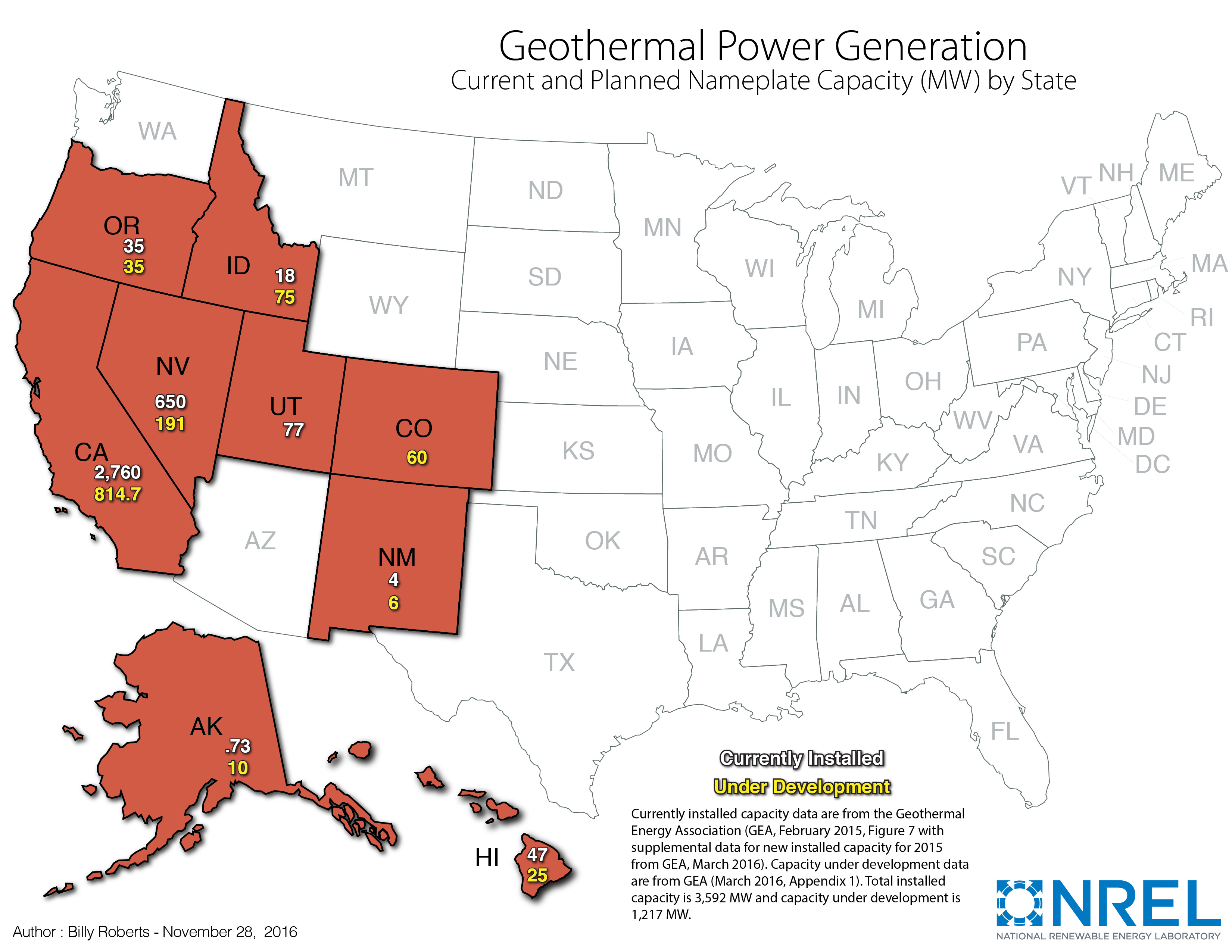
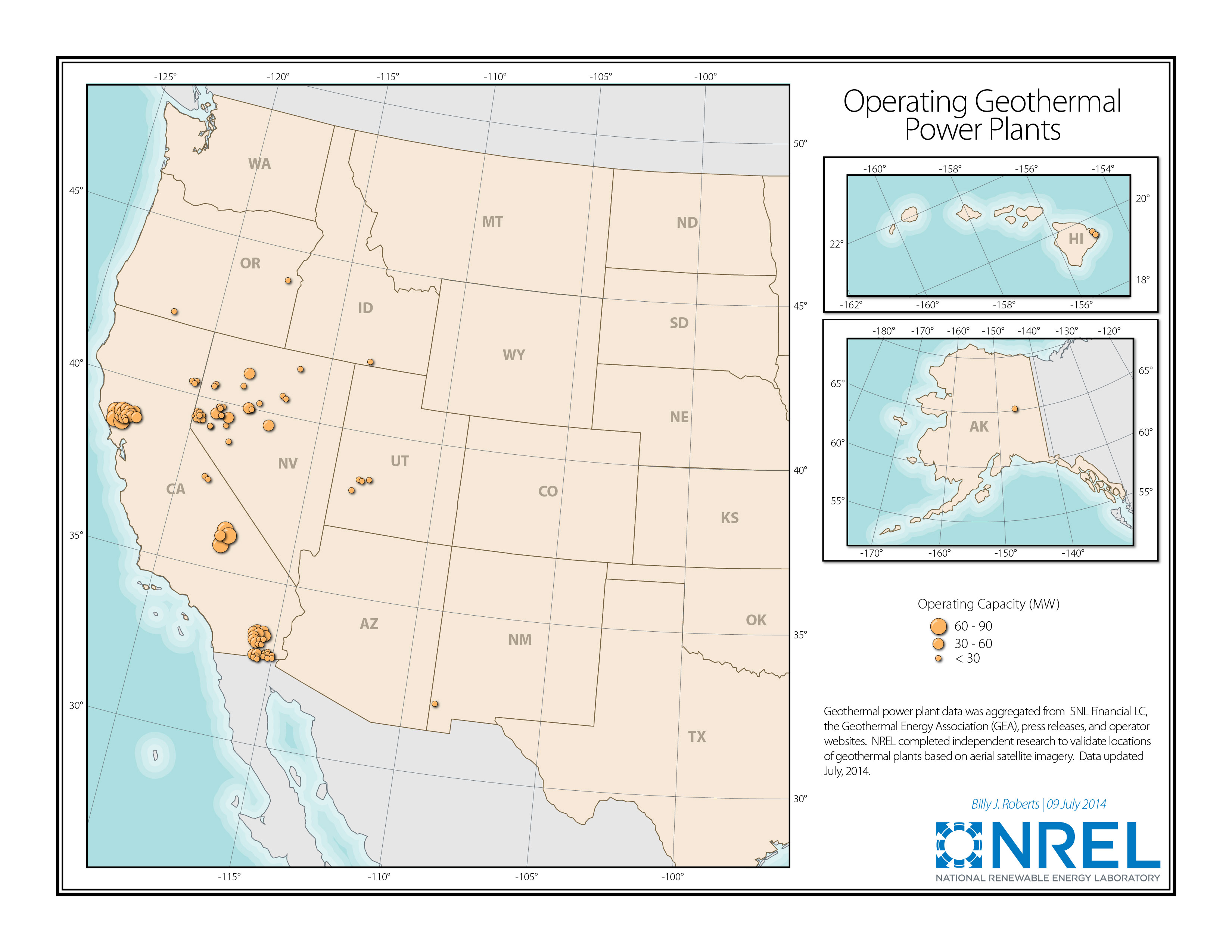
U.S. Geothermal Resource Maps
These static U.S. maps illustrate geothermal power plants, resources for enhanced geothermal systems, and hydrothermal sites. They may be used in electronic and printed publications with proper attribution.
U.S. Geothermal Resource Data Sets
NREL used the following data sets to create the above maps. Note: To view and use these data sets, you need appropriate geographic information system software.
Contact
If you have any questions about the maps or data, please contact us.
Share