
Biomass Resource Data, Tools, and Maps
Explore biomass resource data via our online geospatial tools and downloadable U.S. maps and data sets.
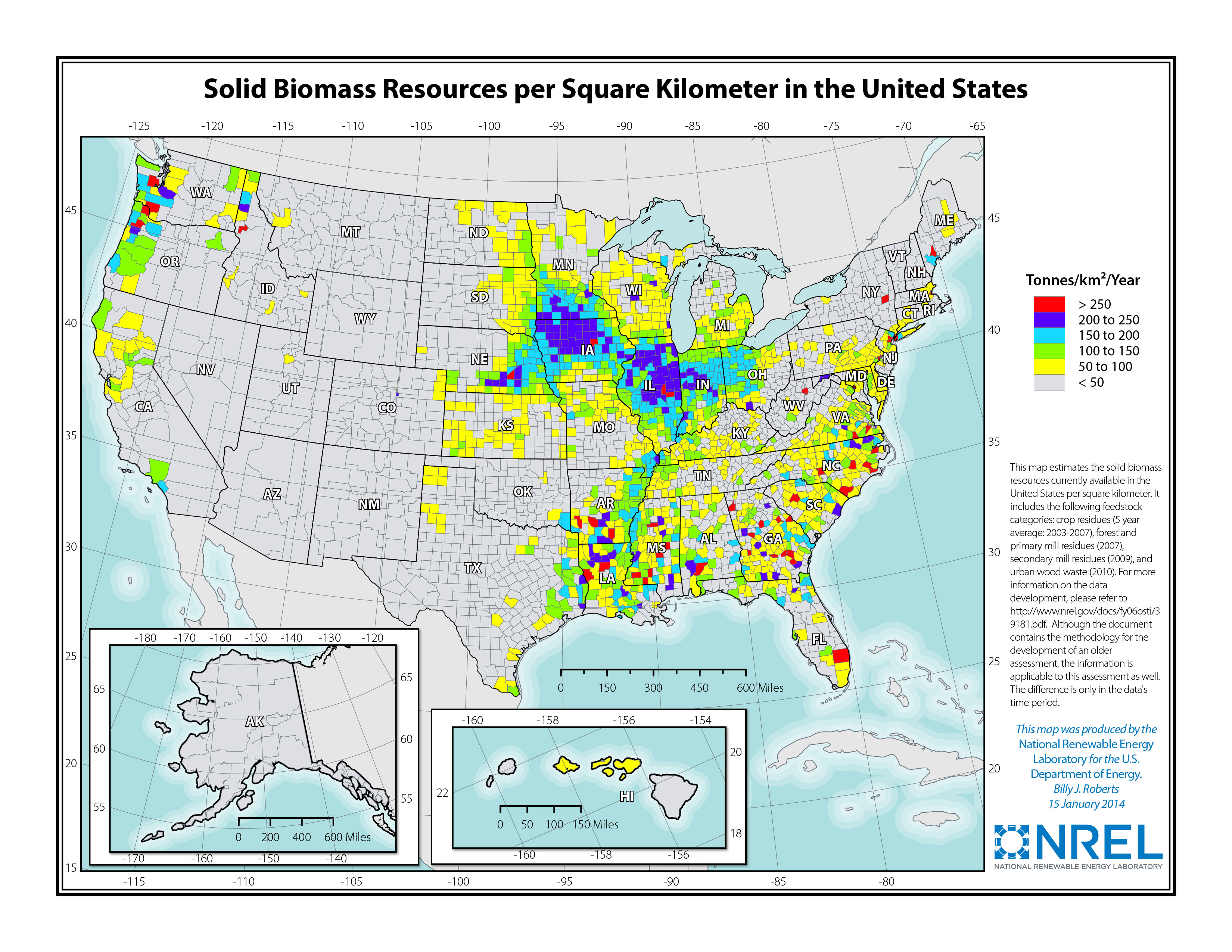
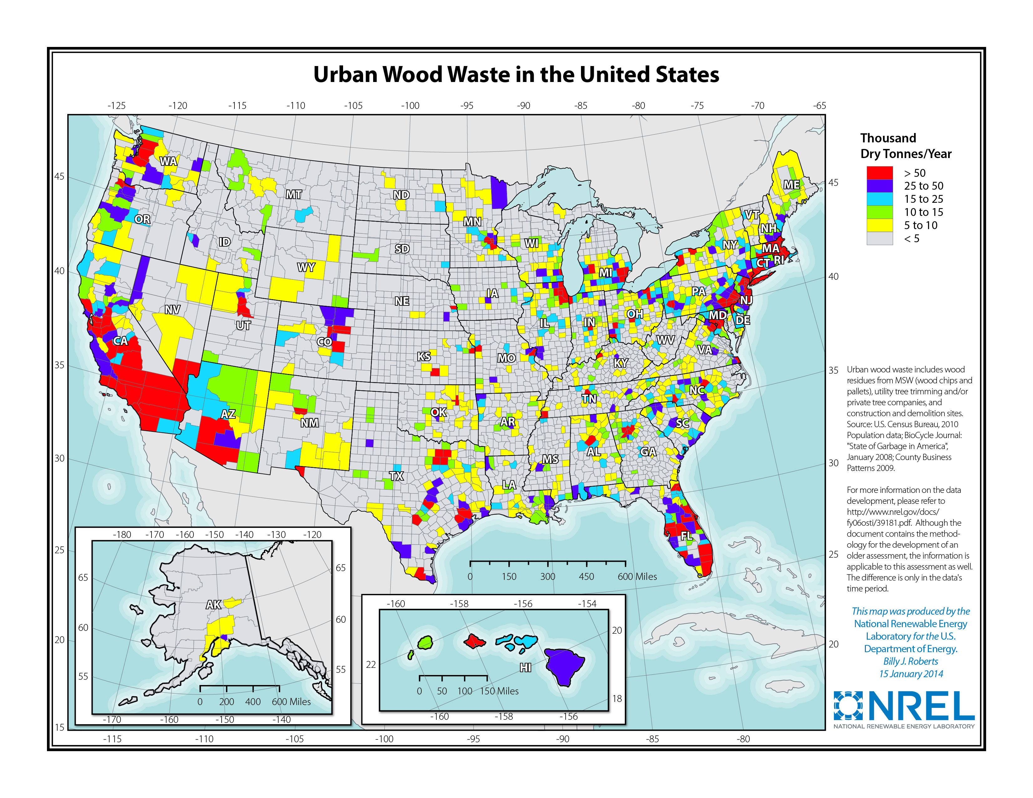
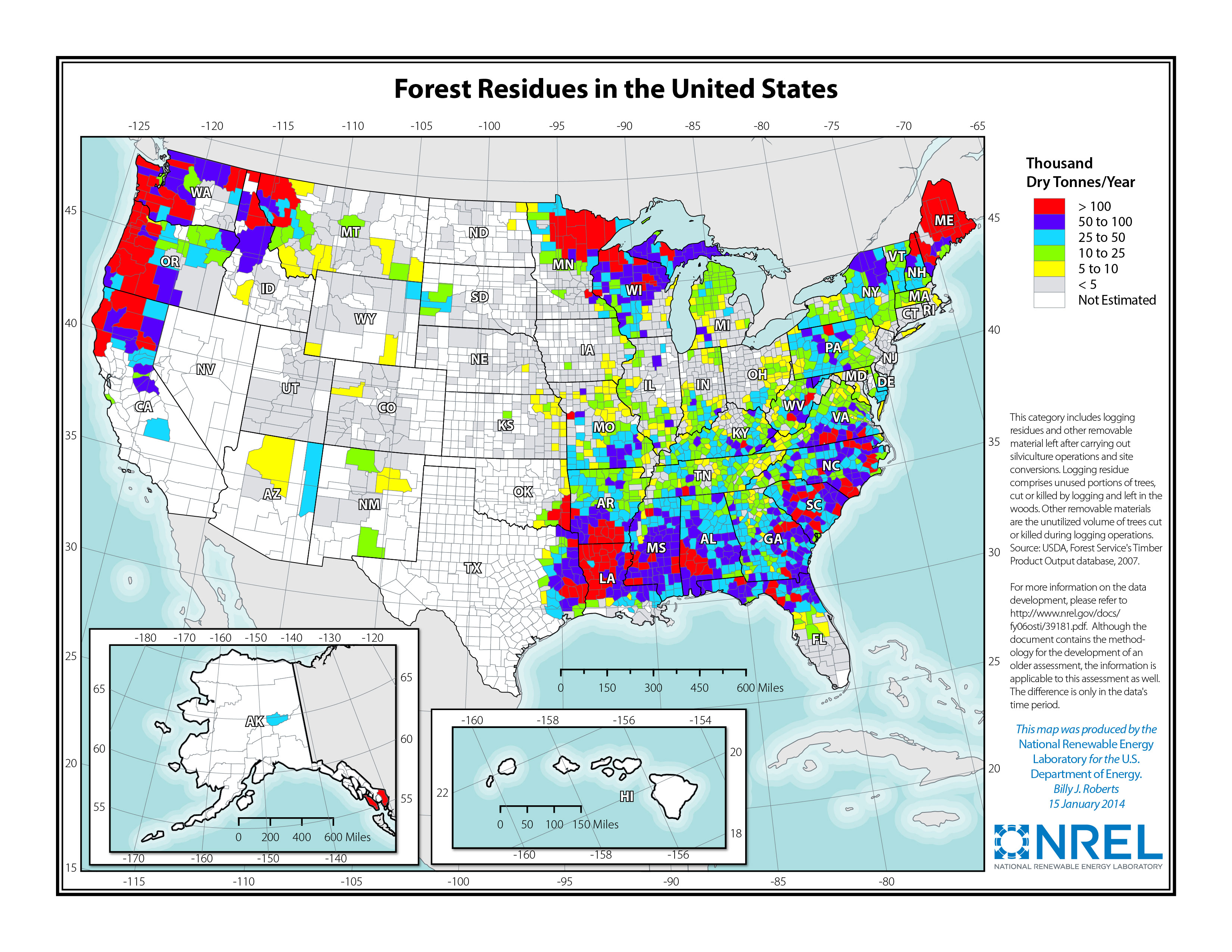
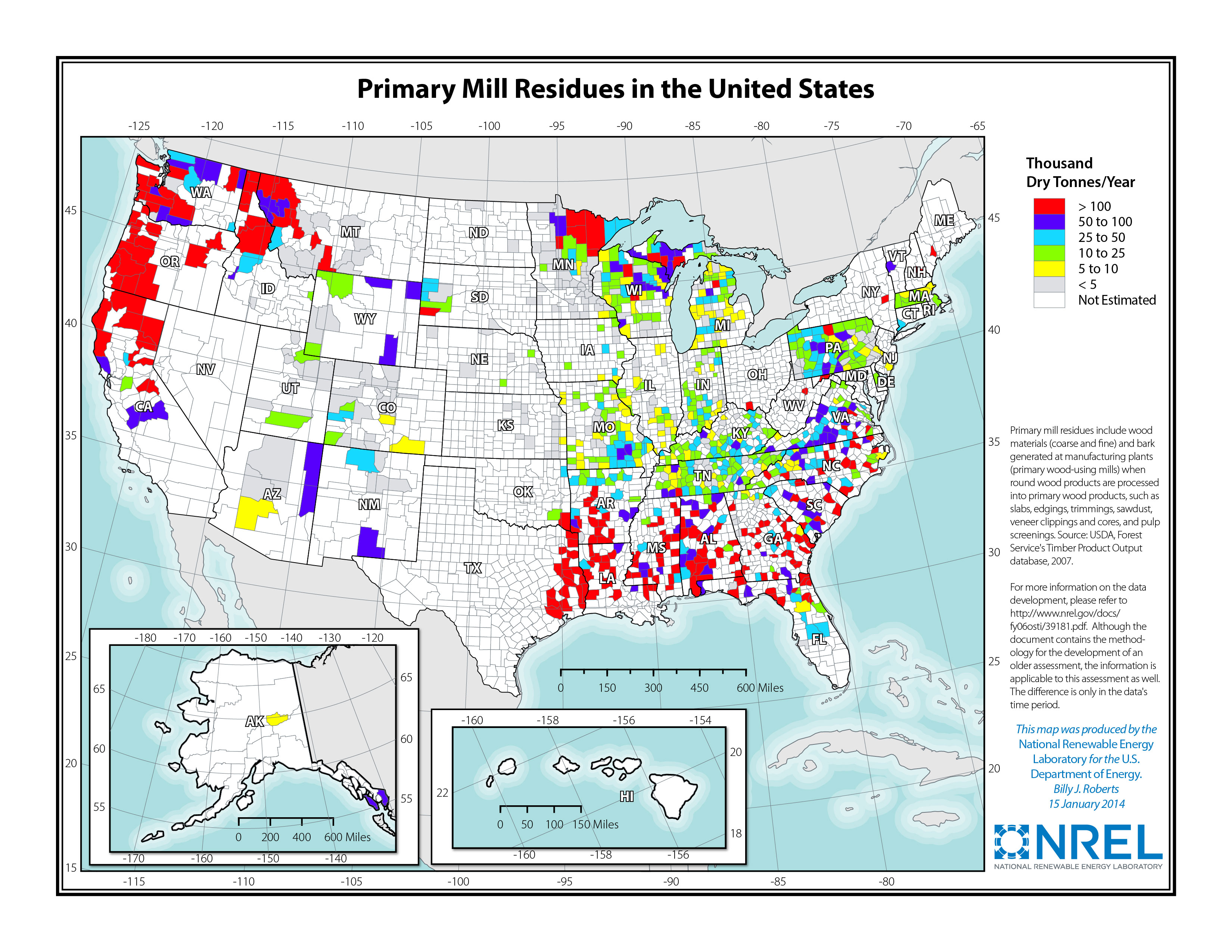
For more information on NLR's data development, see A Geographic Perspective on the Current Biomass Resource Availability in the United States.
Geospatial Data Tools
BioFuels Atlas
Conduct geospatial analysis of U.S. biomass resources and biofuels production.
BioPower Atlas
Conduct geospatial analysis of U.S. biomass resources and power production.
Renewable Energy Atlas
View and explore U.S. biomass and other renewable energy resource data.
Tribal Energy Atlas
Explore techno-economic renewable energy potential on tribal lands.
Renewable Energy Data Explorer
Features biomass data available for the following regions and countries:
U.S. Biomass Resource Maps
These static U.S. maps illustrate biomass resources by county for various resource types or as combined totals.
Publication Date: Jan. 14, 2014
File Type/Resolution: JPG, 300 ppi
Print Format: Letter (8.5” x 11”)
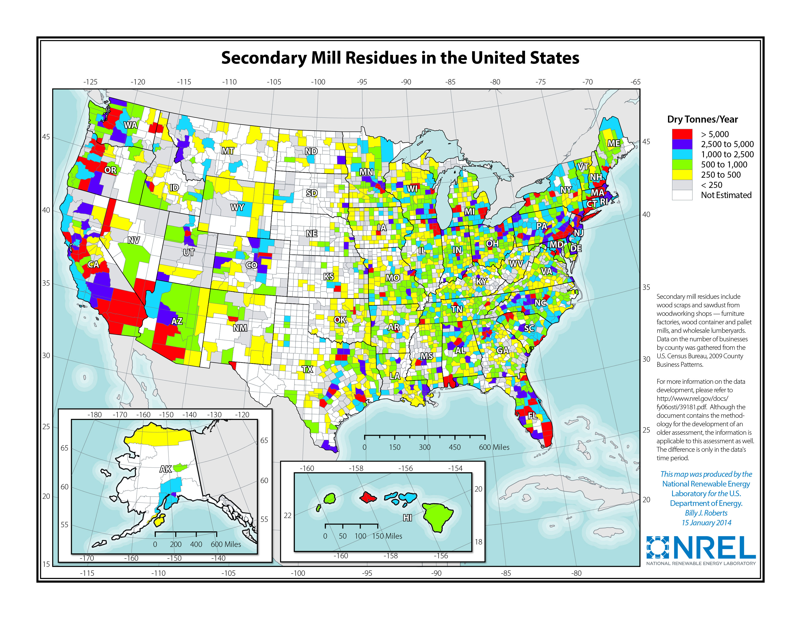
Solid Biomass Resources


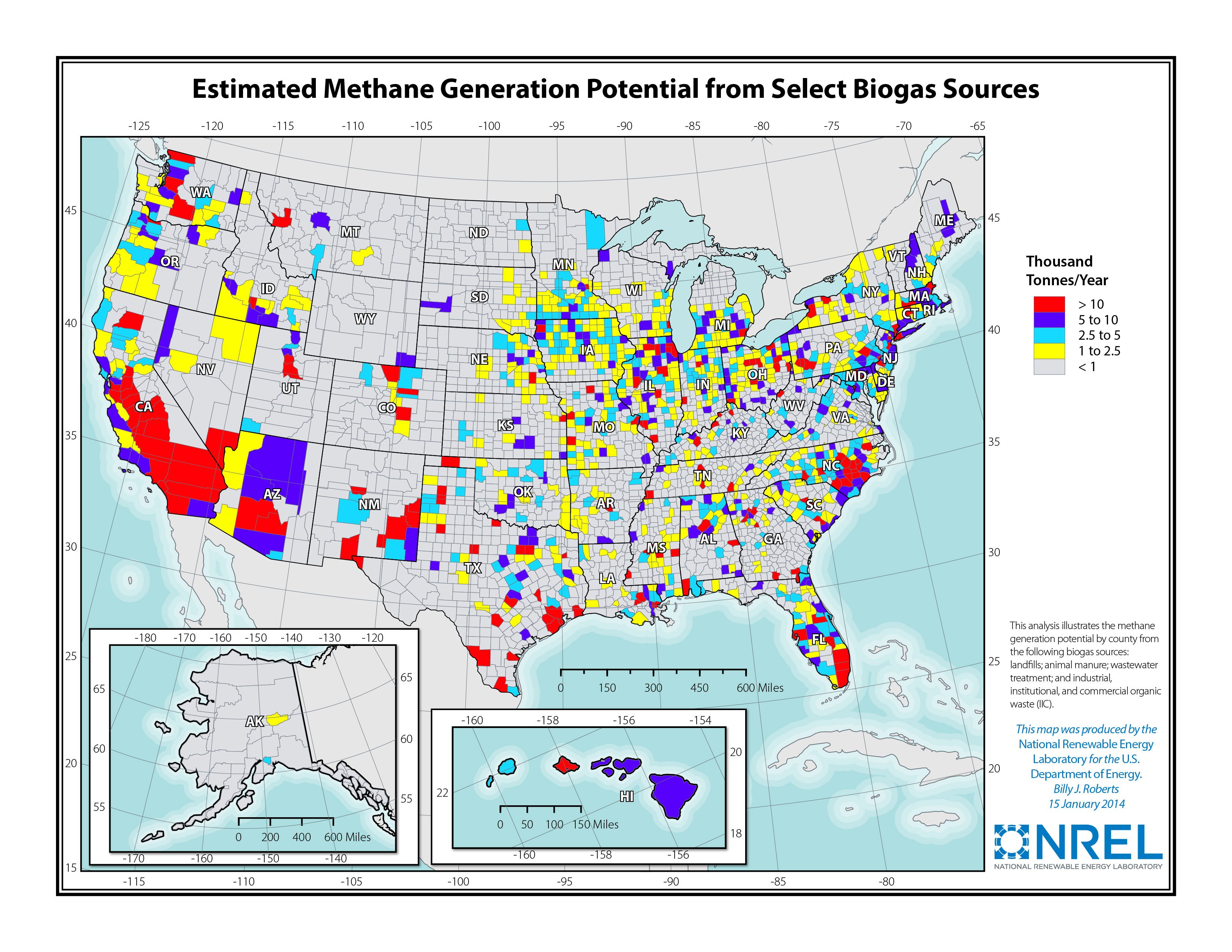
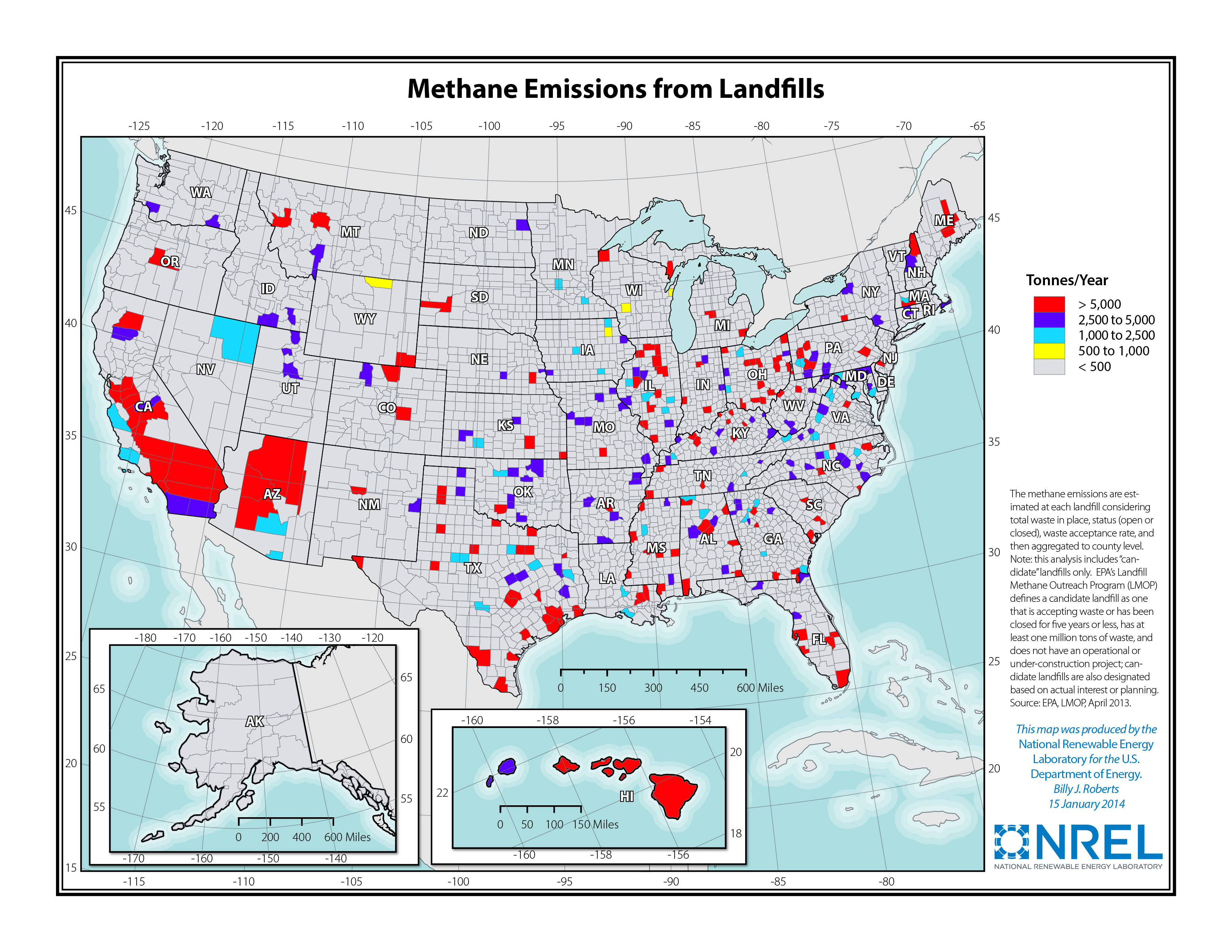
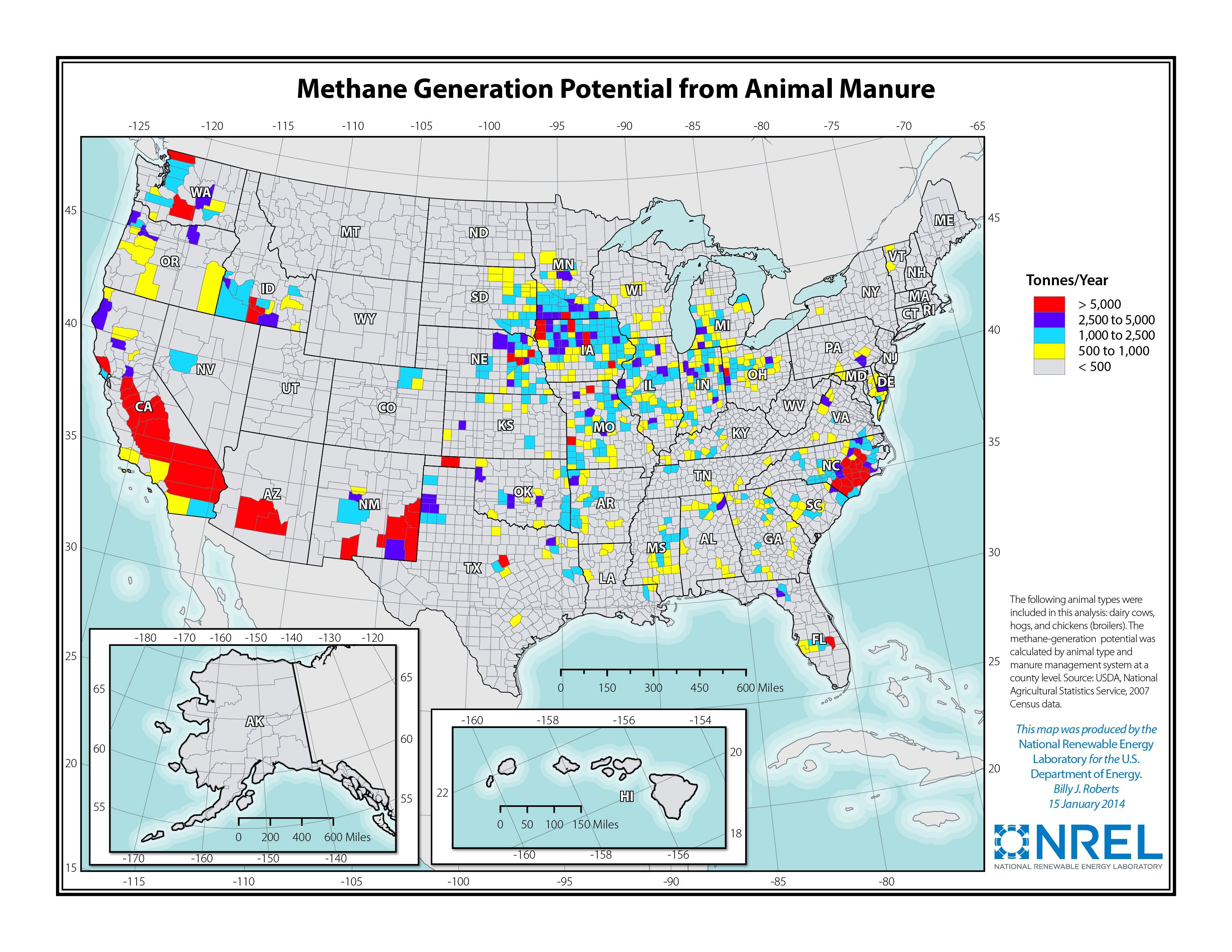
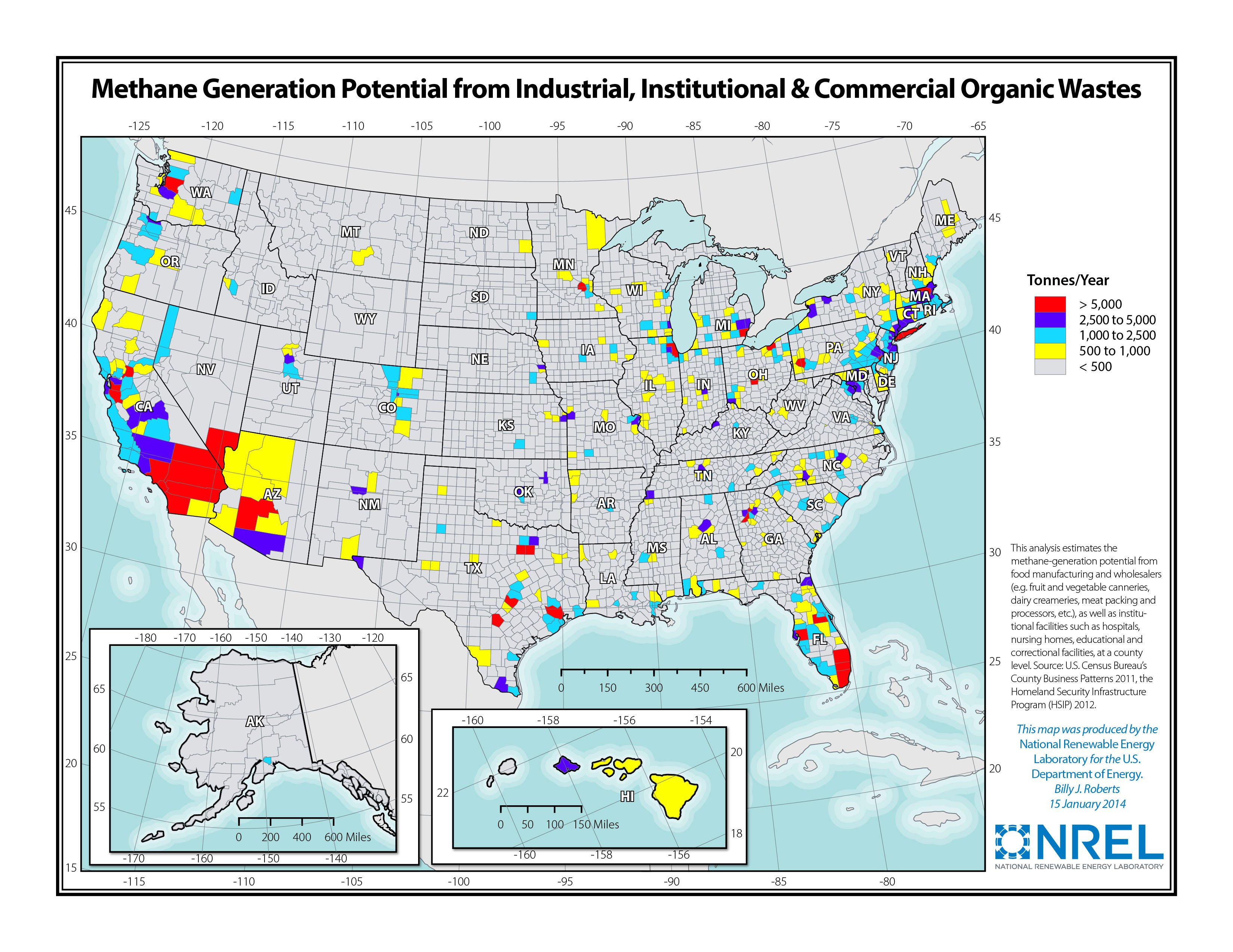
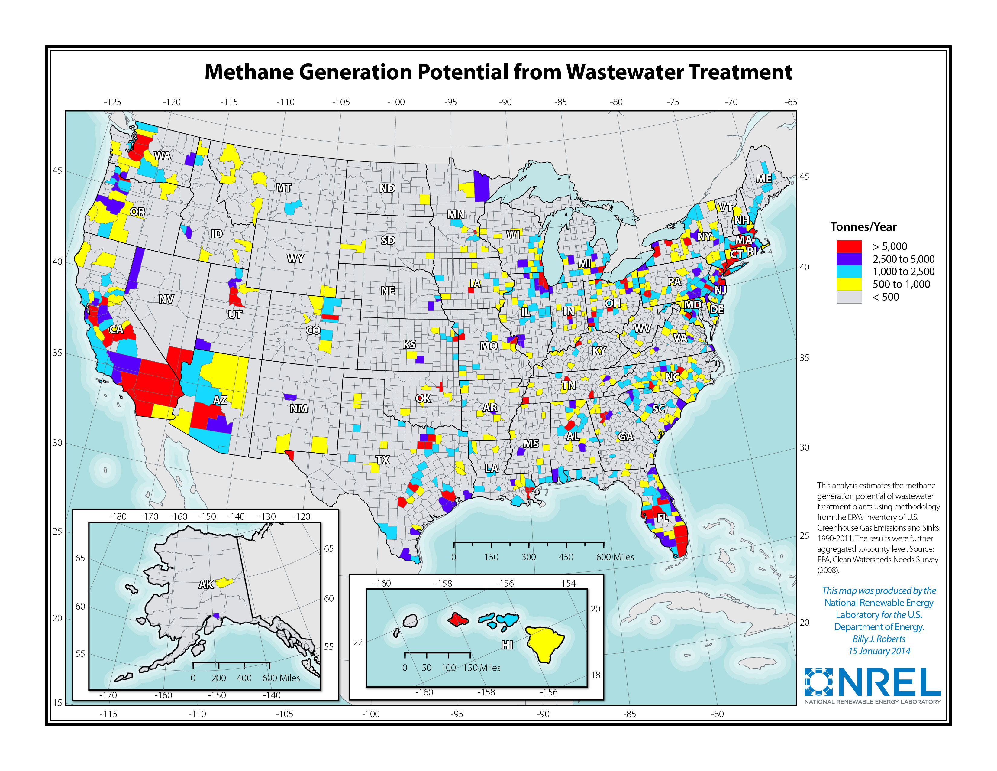
Biogas-Methane Resources


.jpg)
U.S. Biomass Resource Data Sets
NLR used the following data sets to create the above maps. Note: To view and use the data set shapefiles, you need appropriate geographic information system software.
Contact
If you have any questions about the maps or data, please contact us.
Share
Last Updated Dec. 6, 2025