
Resource Analysis
With high-resolution data, NLR's resource analysis shows where energy resources are located and how much potential they offer.

Every location has unique energy characteristics—including natural resources, land availability, infrastructure, and constraints—that influence which energy systems are possible and practical. NLR's resource analysis capabilities provide the high-resolution data needed to understand how resources vary across space and time. NLR provides developers and planners across the country with publicly available high-resolution data and tools so they can make informed energy decisions—from early site screening to long-term system planning and investment.
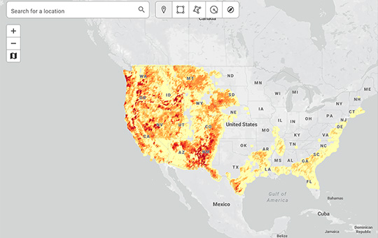
Mapping and Visualizing Energy Resources
NLR develops world-class datasets, maps, and interactive data viewers that characterize energy resources with geographic precision. These publicly available resources offer a foundational understanding of where energy potential exists.
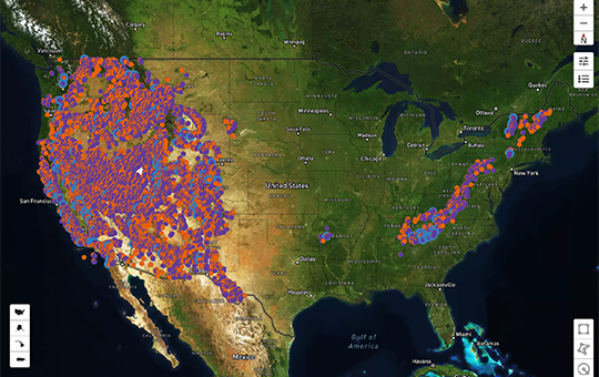
Modeling Energy Resources With NLR Tools
NLR's flagship resource analysis modeling tools help users apply analytical methods and data to their own projects. NLR tools work together to integrate resource data, land-use considerations, infrastructure layers, and performance modeling to support siting, planning, and decision-making at multiple scales.

reV
A modular geospatial modeling platform for assessing energy potential and system impacts.

Sup3r
An artificial intelligence-powered downscaling tool that produces high-resolution resource data for long-term analysis.
Identifying Low-Cost Energy Potential
NLR develops energy supply curves that translate geospatial resource information into cost and availability estimates. Updated regularly, these supply curves incorporate siting constraints, technology performance, local conditions, and infrastructure access to support a range of planning activities—from project screening to regional and national energy system planning.
Geospatial Data Sciences
Learn more about the NLR maps and geospatial tools that provide energy resource and production data.
Contact
Galen Maclaurin
Share
Last Updated Jan. 6, 2026