Google Taps NREL Expertise To Incorporate Energy Optimization into Google Maps Route Guidance
To take a bite out of transportation energy use and emissions and combat climate change, the National Renewable Energy Laboratory (NREL) is partnering with Google to develop more eco-friendly routing in Google Maps.
"Google approached us after learning about our sustainable mobility research and transportation energy analysis capabilities," said Jeff Gonder, who manages NREL's mobility, behavior, and advanced powertrains research. "This is an exciting partnership for us, enabling us to move our internally developed capabilities from the lab to the road for real-world impact at scale."
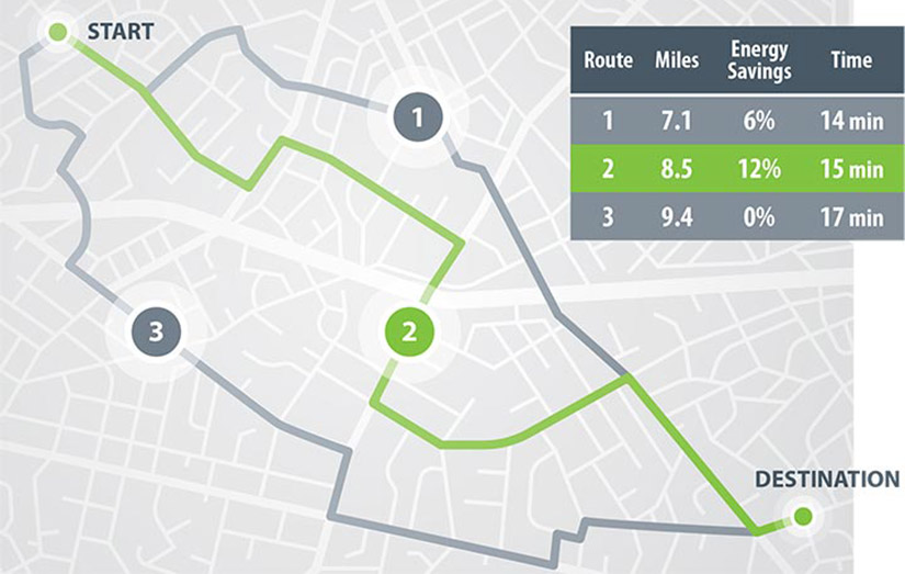
How will it work? Soon, Google Maps will default to the route with the lowest carbon footprint when it has approximately the same estimated time of arrival as the fastest route. In cases where the more eco-friendly route could increase travel time, Google Maps will show users the relative CO2 impact between routes, allowing them to make an informed choice about which route to take.
Google plans to launch its eco-friendly routes option in the United States on Android and iOS later this year, with eventual global expansion, as detailed in the "find more eco-friendly options to get around" section of this Google blog post.
This work leverages a foundation of modeling and analysis tools that NREL developed with support from the U.S. Department of Energy Office of Energy Efficiency and Renewable Energy's Vehicle Technologies Office. It also employs NREL's deep understanding of how all types of on-road vehicles are used in real-world settings as well as the ability to estimate related energy use quickly and accurately.
RouteE: Route Energy Prediction Model

One of the key challenges for eco-routing is that it relies on accurate energy consumption predictions over each road segment for the various types of vehicles on the road. NREL's Route Energy Prediction Model addresses this need.
A vehicle energy-consumption prediction engine, RouteE predicts the energy consumption of a given vehicle over a proposed route. The data-informed model accounts for driving conditions such as anticipated traffic congestion, traffic speed, road type (including number of lanes), road grade, and turns.
As described in relevant publications listed on the RouteE webpage, RouteE is often used in conjunction with real-world travel data from NREL's Transportation Secure Data Center together with energy consumption calculations via the Future Automotive Systems Technology Simulator (FASTSim), which with minimal input data captures the most important factors influencing vehicle fuel economy, performance, and cost.
The Google partnership will leverage both RouteE and FASTSim technologies on top of Google's own datasets and artificial-intelligence capabilities and routing algorithms such as real-time traffic predictions. Google Maps eco-routing integration will serve as one component of Google's broader sustainability efforts. Once integrated, NREL anticipates conducting an objective assessment to see how well the eco-routing capability is working and to help further refine and improve it, as necessary.
Learn more about NREL's sustainable transportation and mobility research and integrated data and analysis tools.
Last Updated Jan. 22, 2026
